29th June ‘09
The sun was shining as we farewelled my cousin, Helen and her daughter Tamra as they left on their 10 day road trip of Tassie. They arrived yesterday from Adelaide to embark on a 10 day road trip around Tassie. It was an ideal opportunity for us to take advantage of being up early so we decided to head to Strathgordon, the nearest town to the Gordon Dam. We headed north along the banks of the Derwent River and then west through New Norfolk. Follow the route with this link.
http://www.whereis.com/?id=87BBC08BADE6B0 New Norfolk is a town that flanks both sides of the river with the Boyer Paper Mill on the northern bank and the road meanders along the southern shore. Because of the recent rainfalls the countryside is lush green and the river was flowing fast. As we turned left to head west along the Gordon River Road we passed through several small towns. Westerway was a small township with a large proportion of land taken up with hop Farms, but at present are just naked trellises waiting for the first sign of spring to allow the plants to burst into life. 5 klm out of the town we past the protesters that are trying to stop the logging out of the forests. This was the last “open” town on our way up as the rest close during the winter. The only traffic we saw from here on were the workmen attending to maintenance on the roads.
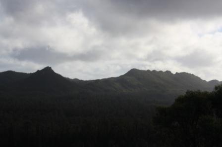
We climbed our way up through the mountains and stopped to view the Saw Back Range, and the lush green ferns that were growing on the roads’ edge amongst the moss.
The road met the banks of Lake Pedder and led to the lookout over this massive lake. Seeing the temperature had not risen, I was nominated to get out of the car to take the photos; at times Alan did position the car so I wouldn’t need to brave the cold mountain air. Outside temperature 6*C with a wind chill factor of -15*C, well that’s what it felt
like!!!
Further along we came across the empty streets of Stathgordon, the town is made up of accommodation houses and amenities all set up for the summer fisherman that come to chase the trout in the lake. Our hopes of getting some lunch up here were dashed! We were weaving our way through the lakes either side of the road until we came to the Gordon Hydro Plant and the end of the road . . . . The Gordon Information Centre(closed) and Dam.
Such a massive dam wall and as the water was low from several years of drought, you could really see the enormity of the project that was undertaken back in 1969.
Gordon River Dam, also known as
Gordon Dam, is a double curvature
arch dam on the
Gordon River in
Tasmania. The Gordon Dam impounds the Gordon River it is 192m long, 2.8m wide and 18m width (at Base) with 157,500 cubic metres of concrete used in the construction that began in 1969 and was opened in 1974. Its height is 140 metres (460 ft), making it the tallest dam in Tasmania and the fifth-tallest in
Australia.
[3]Water from the dam, drops 183 metres (600 ft) underground into the
Gordon Power Station, where three
generators provide about 13% of the electricity for Tasmania.
[4] McPartlans Pass Canal transfers water from Lake Pedder to Lake
Gordon during normal operations and in the opposite direction in the rare event of it being necessary to discharge flood water from Lake Gordon via the control gate at Serpentine. The canal consists of a channel 2743 m long with a control gate 914 m from Lake Pedder end.
We stopped in Westerway on the return trip to get a fair dinkum Hamburger and chips with a nice hot cup of tea for our late lunch. Our 320klm round trip ended when we arrived back in Hobart just after dark . . . 5.15pm!
The Hop Farms at Westerway